| Amherst, New Hampshire Granite Quarries
Return to mindatnh front page.
Click on image for larger view |
This page documents the location and appearence of many Amherst, New Hampshire granite quarries. It is probable that there are many more beyond those shown here.
Photos taken 2014. Adjacent town, Milford, has many larger granite quarries, one still operational. The old Amherst quarries mostly produced quarried granite
for local foundations of barns and farm houses.
|
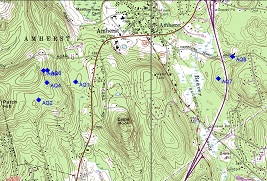
Amherst, NH Topo Map 1 |
Reference: Amherst, NH Topo Map 1
Location: Amherst, NH
Notes: Founder's Way (a new development) is not shown on this topo map. |
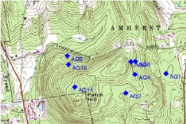
Amherst, NH Topo Map 2 |
Reference: Amherst, NH Topo Map 2
Location: Amherst, NH
Notes: There are many granite quarries on Patch Hill, including several large ones on the south-western (Milford) side.
The Milford Quarry Hill Condominiums encircle a large quarry pond in the lower left side of this topo map view. |
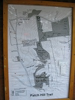
Patch Hill Trail Map |
Reference: Patch Hill Trail Map
Location: Amherst, NH
Notes: The Patch Hill Trail and conservation area is accessable of Lyndeborough Rd. |
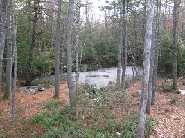
Founders Way, AQ1 42 deg 51.291’ N 71 deg 38.346‘ W
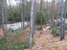
Founders Way, AQ1 42 deg 51.291’ N 71 deg 38.346‘ W |
Reference: AQ1 - Off Founder's Way
Location: 42 deg 51.291’ N 71 deg 38.346‘ W
Notes: Two views |
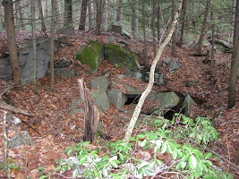
Founders Way, AQ2 42 deg 51.137’ N 71 deg 38.757‘ W |
Reference: AQ2 - Off Founder's Way
Location: 42 deg 51.137’ N 71 deg 38.757‘ W
Notes: |
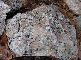
Pegmatite rock Roadside, off Founder's Way |
Reference: Pegmatite rock - off Founder's Way
Location: Roadside, off Founder's Way
Notes: Coarse pegmatite dike rock is present in the country gneiss on Patch Hill. Granite quarries avoided these dikes,
because this rock could not be split into nice square blocks.
These dikes have sometimes been exposed during recent construction activities. The principal mineral components present here are
pink and white feldspar, black biotite mica, and gray quartz. This boulder is about two feet across. |
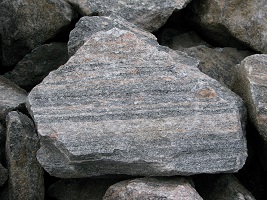
Gneiss rock Roadside, Founder's Way |
Reference: Gneiss rock - off Founder's Way
Location: Roadside, off Founder's Way
Notes: A freshly blasted boulder of banded gneiss rock. This is the typical "country rock" of Patch Hill. The boulder
is about two feet across. Large bodies of homogeneous gray granite are present in the Patch Hill gneiss. These homogenious granite
rock bodies were sought by quarrymen. |
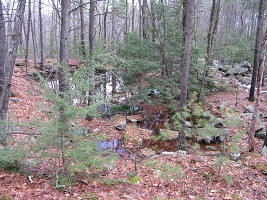
Trail off Founders Way, AQ4 42 deg 51.284’ N 71 deg 38.663‘ W |
Reference: AQ4 - Trail off Founders Way
Location: 42 deg 51.284’ N 71 deg 38.663‘ W
Notes: |
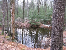
Trail off Founders Way, AQ4 42 deg 51.284’ N 71 deg 38.663‘ W |
Reference: AQ4 - Trail off Founders Way
Location: 42 deg 51.284’ N 71 deg 38.663‘ W
Notes: |
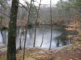
Trail off Founders Way, AQ6 42 deg 51.284’ N 71 deg 38.663‘ W
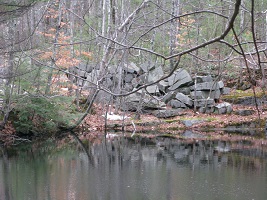
Trail off Founders Way, AQ6 42 deg 51.284’ N 71 deg 38.663‘ W |
Reference: AQ6 - Trail off Founders Way
Location: 42 deg 51.385’ N 71 deg 38.659‘ W
Notes: Two views. A large home has been built adjacent to this quarry pond since this 2014 photograph. |
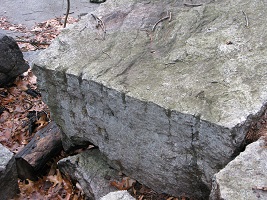
AQ5 - Quarried granite block Trail off Founder's Way |
Reference: AQ5 - Quarried granite block
Location: Trail off Founder's Way
Notes: The three foot long edge of this quarried grinite block shows the series of drill holes that were bored to split it. |
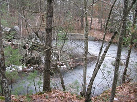
"Sargent Quarry", AQ8 42 deg 51.317’ N 71 deg 36.752‘ W |
Reference: "Sargent Quarry", AQ7
Location: 42 deg 51.499’ N 71 deg 36.596‘ W
Notes: Off Sargent Quarry Rd. |
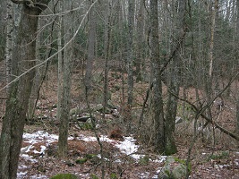
"Carter Quarry", AQ8 42 deg 51.317’ N 71 deg 36.752‘ W |
Reference: "Carter Quarry", AQ8
Location: 42 deg 51.499’ N 71 deg 36.596‘ W
Notes: Off Thorntons Ferry Rd. #1 |
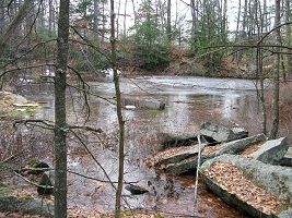
Patch Hill Trail Quarry, AQ9 42 deg 51.428’ N 71 deg 39.357‘ W |
Reference: Patch Hill Trail Quarry, AQ9
Location: 42 deg 51.428’ N 71 deg 39.357‘ W
Notes: |
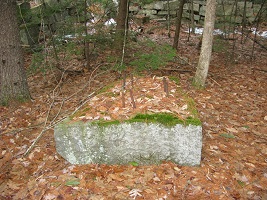
Granite block with steel bolts, AQ9 42 deg 51.428’ N 71 deg 39.357‘ W |
Reference: Granite block with steel bolts, AQ9
Location: 42 deg 51.428’ N 71 deg 39.357‘ W
Notes: This granite block with steel bolts was likely the base for the quarry crane, (see AQ11 photos) |
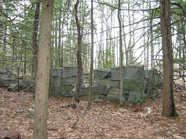
Foundation for workshop, AQ9 42 deg 51.428’ N 71 deg 39.357‘ W
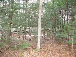
Foundation for workshop, AQ9 42 deg 51.428’ N 71 deg 39.357‘ W |
Reference: Foundation for workshop, AQ9
Location: 42 deg 51.428’ N 71 deg 39.357‘ W
Notes: Two views |
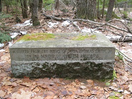
Commerative Bench, AQ9 42 deg 51.428’ N 71 deg 39.357‘ W |
Reference: Commerative Bench, AQ9
Location: 42 deg 51.428’ N 71 deg 39.357‘ W
Notes: |
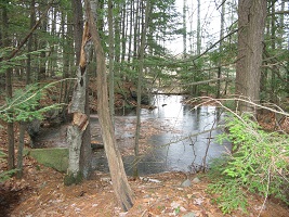
Patch Hill Trail Quarry, AQ9a About 50 yards south of 42 deg 51.428’ N 71 deg 39.357‘ W |
Reference: Patch Hill Trail Quarry, AQ9a
Location: About 50 yards south of 42 deg 51.428’ N 71 deg 39.357‘ W
Notes: There is a second quarry opening about 50 yards south of the AQ9 quarry. |
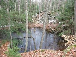
Patch Hill Trail Quarry, AQ10 42 deg 51.360’ N 71 deg 39.384‘ W |
Reference: Patch Hill Trail Quarry, AQ10
Location: 42 deg 51.360’ N 71 deg 39.384‘ W
Notes: Although this quarry is adjacent to the trail, it is not marked on the Patch Hill Trail map, perhaps
it may be on private land.
Most Amherst quarries have remarkably large piles granite waste rock, especially when compared to the size of the quarry pit.
One can ponder the effort required to extract good blocks! |
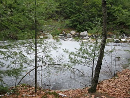
Patch Hill Trail Quarry, AQ11 42 deg 51.184’ N 71 deg 39.240‘ W
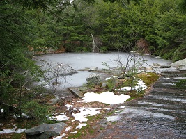
Patch Hill Trail Quarry, AQ11 42 deg 51.184’ N 71 deg 39.240‘ W |
Reference: Patch Hill Trail Quarry, AQ11
Location: 42 deg 51.184’ N 71 deg 39.240‘ W
Notes: Two views. This is the second largest Amherst quarry seen, (AQ6 being the largest). |
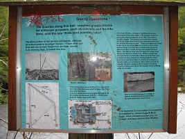
Patch Hill Trail Quarry, AQ11 sign 42 deg 51.184’ N 71 deg 39.240‘ W
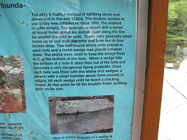
Patch Hill Trail Quarry, AQ11 sign 42 deg 51.184’ N 71 deg 39.240‘ W
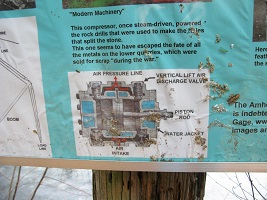
Patch Hill Trail Quarry, AQ11 sign 42 deg 51.184’ N 71 deg 39.240‘ W
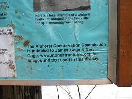
Patch Hill Trail Quarry, AQ11 sign 42 deg 51.184’ N 71 deg 39.240‘ W |
Reference: Patch Hill Trail Quarry, AQ11 sign
Location: 42 deg 51.184’ N 71 deg 39.240‘ W
Notes: This informative sign at the quarry was unexpected.. |
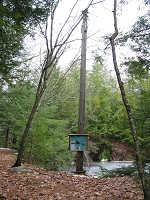
Patch Hill Trail Quarry, AQ11 Mast of derrick 42 deg 51.184’ N 71 deg 39.240‘ W |
Reference: Patch Hill Trail Quarry, AQ11 Mast of derrick
Location: 42 deg 51.184’ N 71 deg 39.240‘ W
Notes: See sign pictoral. |
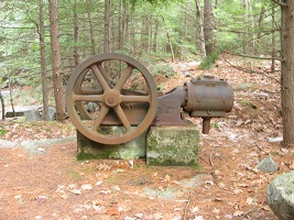
Patch Hill Trail Quarry, AQ11 - Compressor 42 deg 51.184’ N 71 deg 39.240‘ W
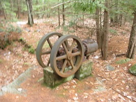
Patch Hill Trail Quarry, AQ11 - Compressor 42 deg 51.184’ N 71 deg 39.240‘ W |
Reference: Patch Hill Trail Quarry, AQ11 - Compressor
Location: 42 deg 51.184’ N 71 deg 39.240‘ W
Notes: Two views |
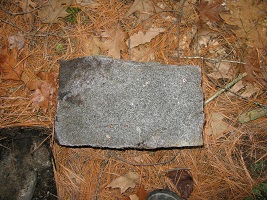
Patch Hill Trail Quarry, AQ11 - Granite block 42 deg 51.184’ N 71 deg 39.240‘ W |
Reference: Patch Hill Trail Quarry, AQ11 - Granite block
Location: 42 deg 51.184’ N 71 deg 39.240‘ W
Notes: A one foot block of homogeneous (quality) gray granite from the AQ11 quarry. (Brown is organic staining.) |
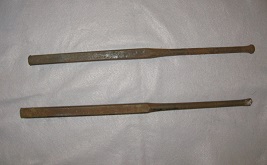
18 inch drills for granite quarrying
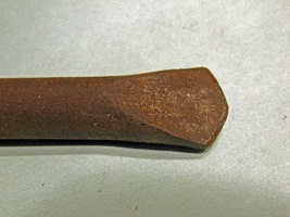
The drill end was a flat tapered wedge. |
Reference: 18 inch drills for granite quarrying, tip.
Location:
Notes: From the collection of Tom Mortimer, Amherst, NH
The drill end was a flat tapered wedge. |


